

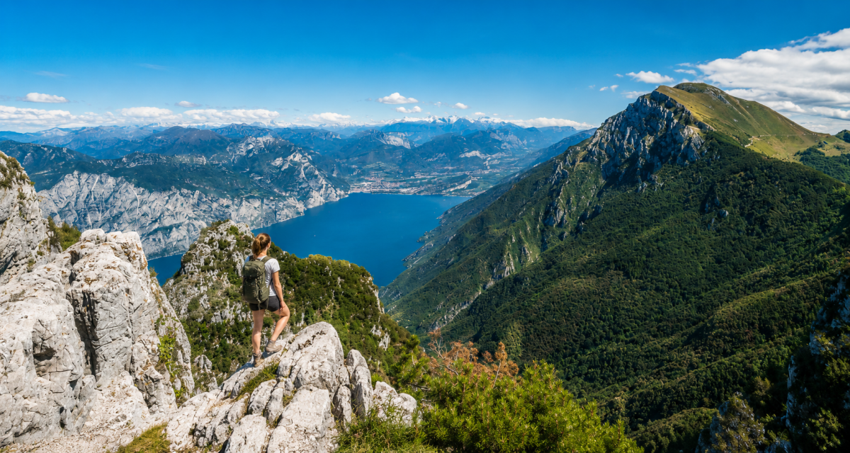
Suspended between sky and lake, the Sentiero del Ventrar is a loop trail that crosses one of the most panoramic stretches of Monte Baldo, offering breathtaking aerial views of Lake Garda.
The trail runs at altitude, between 1,473 and 1,756 metres, alternating ups and downs in the forest with open stretches with direct views of the lake. The name ‘Ventrar’ evokes the wind that often blows over these ridges – and indeed, walking here one really does have the feeling of being suspended between mountain and water.
The route
The start is from the Zocchi Alti car park, above Bocca di Navene. After an initial stretch on a dirt road, you take the Ventrar path, which plunges into the forest and begins to descend towards the side of the lake. The route alternates between uphill and downhill stretches, with panoramic passages suddenly opening out onto the blue expanse of Lake Garda.
It then climbs diagonally up to the Malcesine cable car station, before returning to the starting point along the ridge trail and a descent on a dirt road.
Flowering and season
The best time to walk the Ventrar is between June and July, when rhododendrons and wild orchids colour the high-altitude meadows. The trail has some exposed sections. It is not suitable for those who suffer from vertigo and requires appropriate hiking boots.
Characteristics
Directions
From the Zocchi Alti parking area (above Bocca di Navene), climb approximately 150 m on an unpaved road. Then take the Ventrar trail to the right, which descends into the forest towards the lake side.
The route alternates between climbs and descents with open, panoramic sections overlooking Lake Garda. You will cross alpine meadows and forests until you climb diagonally towards Malcesine's cable car station.
The return journey follows the ridge trail and then descends on unpaved road back to the starting parking area.
How to get there
By car: from the Rovereto Sud motorway exit, head towards Mori and then climb towards the Brentonico plateau. Continue for 12 km after Brentonico towards San Valentino, cross the San Valentino Pass and follow the Graziani Road to Bocca di Navene. Turn left 200 m after Rifugio Navene towards the parking area.
Alternative: Malcesine cable car to Monte Baldo station, then connecting trail.
Where to park
Zocchi Alti parking area, above Bocca di Navene. Free, limited spaces. Coordinates: 45.782403, 10.867224.
Starting point coordinates
Recommended gear
Mountain boots with rigid sole. Windproof jacket and thermal layer (it's cool at altitude even in summer). At least 1.5 liters of water, food, sunscreen. Trekking poles recommended.
Safety
Trail with exposed sections: not suitable for those with vertigo and not recommended for small children. Check weather conditions before departure — weather changes rapidly at altitude. Check with the local tourist office for trail conditions. Emergencies: 112.
Loading forecast...
Need help planning?
Our AI assistant knows every trail around Lake Garda.
 Ask about this route...


