

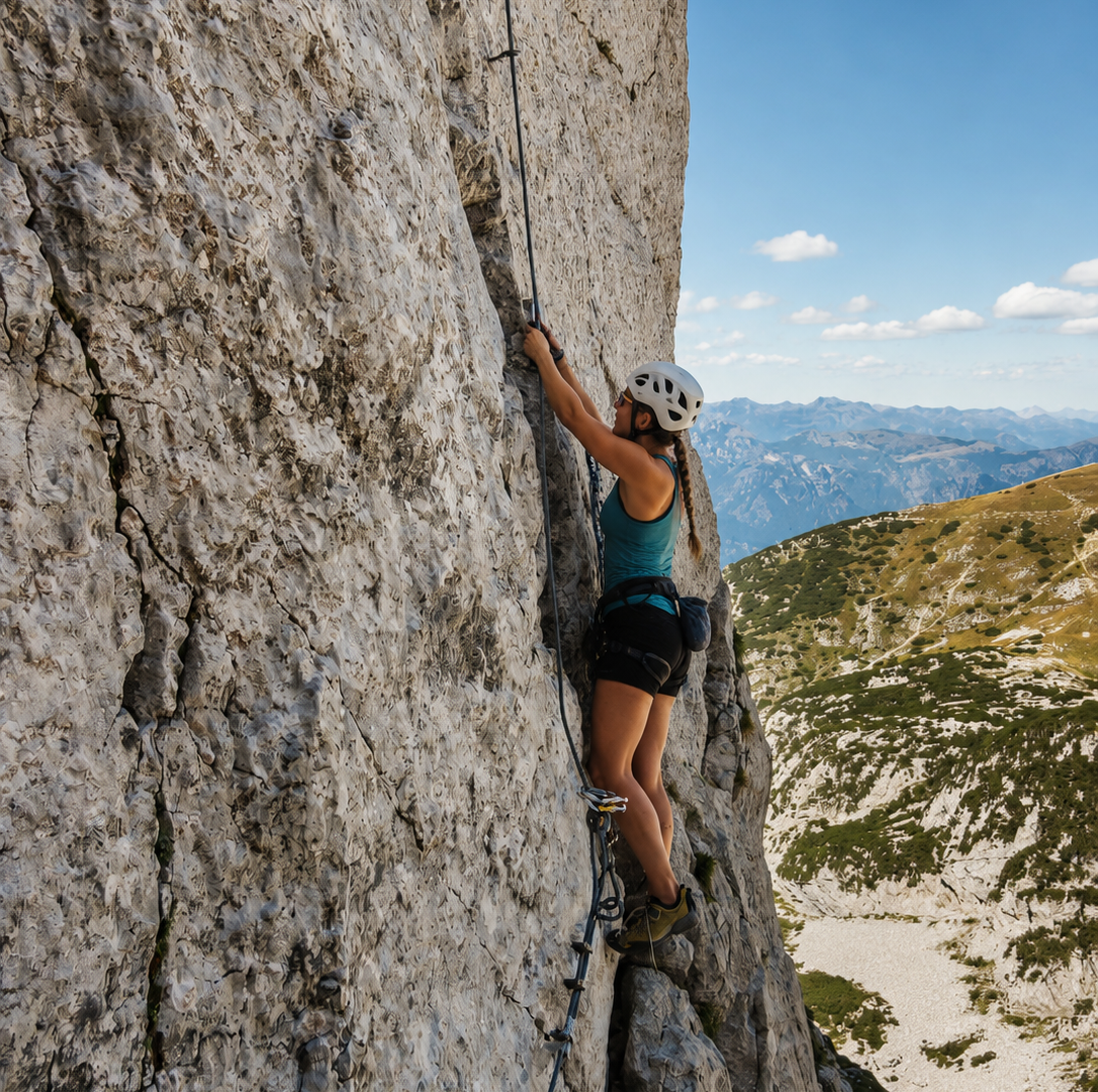
The Via Ferrata delle Taccole is one of the most challenging ferratas on Lake Garda: a long and technical route on the walls above Malcesine that requires experience, stamina and a complete lack of vertigo. With 400 metres of equipped height difference and a 6-hour walk, it is reserved for experienced ferratists.
The route
The attack of the ferrata is reached from Malcesine after an approach through the forest. The route runs along the limestone walls of the western slope of Monte Baldo, with long equipped sections requiring arm strength and resistance to fatigue.
The name ‘Taccole’ comes from the jackdaws (alpine crows) that nest on the walls: their constant presence during the ascent is a noisy but friendly companion. The rock is limestone, generally solid, with sections where natural holds supplement the steel cable.
Key points
The route includes exposed traverses with aerial views of the lake, vertical chimneys and passages where the emptiness underfoot is impressive. The length of the via ferrata is the most challenging factor: 6 hours of walking require intelligent management of energy and belays. Some equipped descent passages add technical variety.
Practical tips
Ferrata K4, only for experts with excellent physical preparation. Complete kit compulsory: harness, via ferrata set with dissipator, helmet. Bring plenty of water (at least 2 litres) and food. Departure at dawn is recommended in order to have the necessary hours of light. Do not tackle in uncertain weather conditions. Period: June-September. Mountain guides available in Malcesine and the Baldo area.
Characteristics
Directions
Departure is from the locality of Vignole above Arco and the via ferrata entrance is reached via a forest trail. The ferrata climbs along the limestone wall with vertical sections, aerial traverses and athletic passages.
The route offers spectacular views of the Sarca Valley and Lake Garda. From the summit, descent is by trail back to the starting point.
How to get there
By car: reach Arco, then follow signs for Vignole. About 10 minutes from Riva del Garda. By public transport: bus to Arco, then on foot.
Where to park
Parking in the Vignole area, above Arco. Limited spaces.
Starting point coordinates
Recommended gear
Complete via ferrata kit: harness, ferrata set with shock absorber, helmet. Mountain boots. Ferrata gloves. Water, energy snacks.
Safety
Via ferrata di difficolta medio-alta (K3-K4). Richiede esperienza e buona forma fisica. Non percorrere in caso di pioggia o temporale. La parete e esposta: evitare le ore piu calde in estate. Emergenze: 112.
Loading forecast...
Need help planning?
Our AI assistant knows every trail around Lake Garda.
 Ask about this route...


