

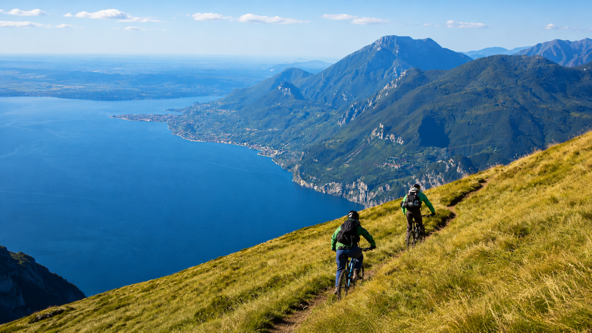
Trail 601 is the most iconic downhill on Lake Garda: a descent from Monte Baldo to Malcesine on technical single tracks with breathtaking aerial views of the lake. 18 km of pure adrenaline with 1700 metres of negative altitude difference, reserved for experienced bikers with full protections.
The route
You ascend by cable car from Malcesine to the summit of Monte Baldo (1760 m), where the panorama sweeps from Lake Garda to the Dolomites. From here begins the descent along Trail 601, which plunges through alpine meadows, beech forests and rocky terrain with gradients that test even the most experienced riders.
The first section crosses the summit ridge of Baldo with vertiginous views on both sides. The technical difficulty is immediately high: moving stones, steps and exposed passages demand maximum concentration. The trail then enters the forest, where roots and wet ground add to the challenge.
Key sections
The most technical part is the central section with sequences of tight hairpin bends over stony terrain, where the choice of line is crucial. The last kilometres before Malcesine offer smoother but still sustained passages, with the lake appearing between the trees as a reward for the effort.
Practical advice
Only for experienced bikers with full protections: full helmet, knee pads, elbow pads and gloves. Full-suspended MTB with generous travel (160mm+). The Malcesine cable car accepts bikes at extra charge – check timetables and book in high season. Trail 601 is open from June to October, weather conditions permitting. After the descent, Malcesine offers lakeside restaurants to recover your energy.
Characteristics
Directions
From the San Zeno di Montagna parking area, take Trail 601 which climbs through the beech forest on the western slope of Monte Baldo. The path is a classic trail running and mountain biking route, with mixed terrain including single track, gravel, and brief rocky sections.
You climb with constant gradient up to the Baldo ridge, from where you can enjoy a panoramic view of the entire Lake Garda. The descent follows parallel paths that lead back to San Zeno.
How to get there
By car: from Caprino Veronese head towards San Zeno di Montagna following the signs. About 40 minutes from Verona. By public transport: bus from Caprino Veronese to San Zeno di Montagna.
Where to park
Parking at San Zeno di Montagna, near the town center or in the designated areas for hikers.
Starting point coordinates
Recommended gear
Trail running shoes or mountain bikes with suspension. Water (at least 1.5 liters), energy food, windproof jacket. For MTB: helmet, protective gear, repair kit.
Safety
Trail with technical sections and challenging slopes. Pay attention to rocky areas and exposed roots. In case of rain the ground becomes very slippery. Share the trail with other users (hikers, bikers). Emergencies: 112.
Loading forecast...
Need help planning?
Our AI assistant knows every trail around Lake Garda.
 Ask about this route...


