

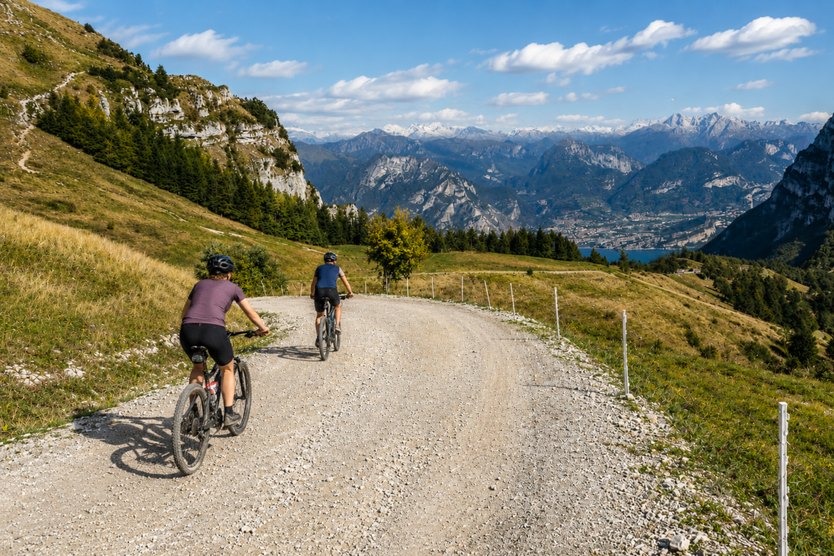
The Monte Baldo Red Tour is a 35 km MTB route on the ridge of Monte Baldo above Malcesine, with cable car access and descent on scenic trails with aerial views of Lake Garda. An epic experience for experienced bikers that combines the convenience of the cable car with the challenge of high altitude single tracks.
The route
You ascend by cable car from Malcesine to the summit of Monte Baldo (1760 m), where the 360-degree panorama from the Dolomites to the Po Valley takes your breath away. The Red Tour follows the ridge of Mount Baldo southwards on scenic trails that alternate between alpine meadows, rocky terrain and beech forests, with the lake always visible 1500 metres below.
The route is mainly at high altitude, with a limited altitude difference (375 m) compared to the length thanks to the undulating profile of the ridge. The technical difficulty is in the downhill single track: moving stones, roots and tight hairpin bends require experience and bike mastery.
The trails
The Red Tour includes some of the most scenic trails on Baldo: ridge passages with vertiginous views on both sides, flowing descents through flowery meadows and technical sections in the forest. The name ‘Red’ indicates the medium-high difficulty of the trails, which are suitable for bikers with good experience.
Practical tips
For experienced bikers only. Full-suspended MTB with good travel. Helmet, knee pads and gloves compulsory. Malcesine cable car accepts bikes at extra charge – book in high season. Bring water and food: there are no huts on the ridge. Period: June-October. After the tour, Malcesine offers lakeside restaurants for a well-deserved recovery.
Characteristics
Directions
The Red Tour is a challenging mountain bike route that starts from the Malcesine cable car station (1,760 m) and descends towards the lake through technical trails and single tracks.
The route crosses alpine meadows, coniferous forests and rocky terrain with technical descents and demanding passages. It descends over 1,500 meters in elevation to Malcesine.
How to get there
In funivia: da Malcesine prendere la funivia rotante per il Monte Baldo. Trasporto bici consentito con supplemento. In auto: parcheggiare a Malcesine.
Where to park
Parking in Malcesine, cable car area. Paid parking. Arrive early in summer.
Starting point coordinates
Recommended gear
Mountain bike full suspended con freni a disco. Casco integrale obbligatorio. Protezioni complete (ginocchiere, gomitiere, paraschiena). Guanti, occhiali. Kit riparazione, acqua, cibo.
Safety
Enduro/downhill route for very experienced bikers. Extremely technical sections with rocks, roots and drops. Not suitable for beginners. Check trail and weather conditions before departing. Emergencies: 112.
Loading forecast...
Need help planning?
Our AI assistant knows every trail around Lake Garda.
 Ask about this route...


