

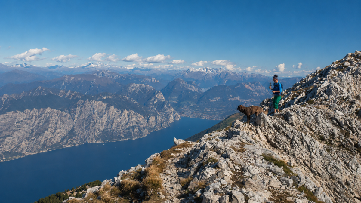
Cima Valdritta from Novezzina
Ferrara di Monte BaldoThe Cima Valdritta (2218 m) is the highest peak of Monte Baldo and one of the most spectacular natural viewpoints in the Pre-Alps: from its summit you can dominate Lake Garda, the Po Valley, the Dolomites and, on clear days, the Apennines. A demanding 13 km hike with almost 1000 metres of altitude difference that repays every effort.
The route
It starts at the Novezzina Botanical Garden (1230 m), which can be reached by car from the Adige Valley. The path climbs through flower-filled alpine meadows – Monte Baldo is known as the ‘Hortus Europae’ (Garden of Europe) for its extraordinary botanical variety – towards the Fiori del Baldo Refuge, the ideal first stop.
From here, the route becomes more demanding: we climb up the Baldo ridge on a stony path with steep sections to Cima Valdritta. The last part requires attention due to the moving stones and exposure, but does not present any real technical passages. The panorama gradually opens up and is total from the summit.
Flora and panorama
Monte Baldo is home to over 1500 plant species, many of which are endemic. During the ascent, you cross different vegetation belts: from meadows with orchids and gentians to alpine meadows with edelweiss and saxifrage. From Cima Valdritta the panorama is 360 degrees: Garda 2000 metres below, the Adamello Group, the Brenta Dolomites, and on exceptional days Monte Rosa.
Practical advice
Long and demanding excursion. Trekking boots with hard soles, layered clothing, windproof jacket. Bring water and food – Rifugio Fiori del Baldo is the only refreshment point. Depart early in the morning to avoid summer afternoon storms. Period: June-October. The weather at high altitudes is unpredictable: check the local forecast before setting off.
Characteristics
Directions
From Rifugio Novezzina (1,232 m), take the trail that climbs towards Cima Valdritta (2,218 m), the highest peak of Monte Baldo. The route crosses alpine meadows rich in endemic flora (Monte Baldo is known as the Garden of Europe).
The ascent is constant and challenging in the final section, on rocky terrain. From the summit, the panorama spans from Lake Garda to the Dolomites, extending to the Po Valley. Return by the same route.
How to get there
By car: from Caprino Veronese, climb towards Ferrara di Monte Baldo and continue to Rifugio Novezzina. Narrow mountain road. About 1 hour from Verona. Alternatively: cable car from Malcesine and connecting trail.
Where to park
Parking at Rifugio Novezzina. Free, limited spaces.
Starting point coordinates
Recommended gear
Mountain boots with ankle support and rigid sole. Windproof jacket and thermal layer even in summer. Trekking poles. At least 2 liters of water, energy food, sunscreen. Map of Monte Baldo trails.
Safety
High mountain route with significant elevation gain. Check weather conditions before departure. Weather at altitude changes rapidly: do not set out if thunderstorms are forecast. The final section to the summit is rocky and requires careful footing. Emergencies: 112.
Loading forecast...

Need help planning?
Our AI assistant knows every trail around Lake Garda.
 Ask about this route...


