

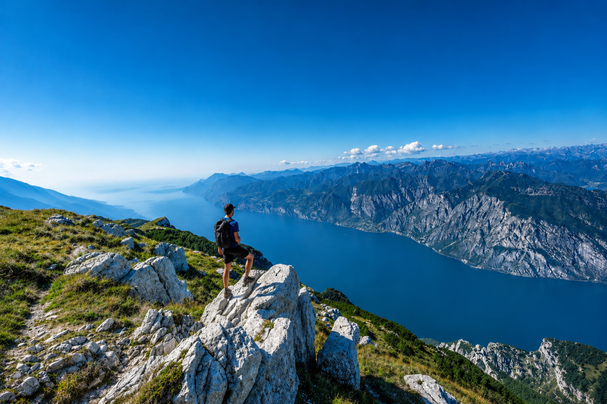
The Monte Baldo Cresta traverse is the excursion par excellence for those who want to experience Baldo in its most authentic and grandiose dimension. A long walk along the ridge line that joins some of the most emblematic peaks of the massif, with Lake Garda accompanying every step like a faithful travelling companion.
The starting point is the Baita dei Forti, easily reached by the panoramic cable car from Malcesine, which climbs from 90 to about 1,800 metres in just a few minutes. From here, the CAI 651 path opens out onto a world suspended between sky and lake, following the main Baldo peaks in succession: Cima Pozzette, Cima Longino, the majestic Cima Valdritta – the highest point of the massif – Punta Pettorina to Cima Telegrafo, where the Telegrafo Refuge is located.
The route covers about 18.5 kilometres with a positive altitude difference of 1,183 metres, and is classified as an itinerary of medium difficulty. It requires good physical preparation and, in the southern part of the route, attention to the signs, which are not always clearly visible. In the event of fog, it is essential not to leave the marked path.
At these altitudes, the nature of Baldo shows itself in all its splendour: expanses of rhododendrons, edelweiss, gentian and dozens of other botanical species that have made this massif famous throughout Europe. The view sweeps from Lake Garda to the Dolomites, from Adamello to the Po, in one of the most spectacular panoramic settings in the southern Alps.
The return trip is along the same ridge (outward and return route) or down to Malcesine to take the cable car. A whole day in the most beautiful mountain of Lake Garda.
Characteristics
Directions
1. Reach the upper station of the Malcesine cable car (approximately 1,800 m) and proceed towards Baita dei Forti (1,735 m), the official starting point of the route.
2. Take CAI trail 651 heading north, following the ridge towards Cima Pozzette (2,132 m): the path is well-marked in this section.
3. From Cima Pozzette continue along the ridge towards Cima Longino, with wide panoramic views of Lake Garda to the east and Trentino valleys to the west.
4. Continue along the ridge to Cima Valdritta (2,218 m), the main peak of Monte Baldo: an ideal spot for a scenic rest.
5. From Valdritta descend slightly and climb again towards Punta Pettorina, with some sections on rocky terrain.
6. Proceed towards Cima Telegrafo (approximately 2,200 m), home to Rifugio Telegrafo: a rest point and destination of the traverse.
7. The return is made by retracing the ridge in reverse to Baita dei Forti, or by descending towards Malcesine to take the cable car.
How to get there
By car: reach Malcesine by taking the SR249 Gardesana Orientale along the Verona shore of Lake Garda. In Malcesine follow the signs for the cable car (Funivia Monte Baldo). Park in town or in designated areas near the lower station.
By bus: Malcesine is served by ATV (Verona) regular bus lines and seasonal connections from Lake Garda. The Malcesine cable car is the most convenient way to reach the route's starting elevation (upper station approximately 1,800 m).
By cable car: the panoramic Malcesine cable car rotates 360 degrees and offers one of the most spectacular ascents in the Alps. Check updated times and fares on the cable car's official website.
Where to park
Several parking areas are available in Malcesine near the cable car: paid parking in town and rest areas along the lake shore. During peak season (July-August) it is advisable to arrive early in the morning or use peripheral parking with shuttle service. Those hiking up from the valley floor can also park in the higher hamlets of Malcesine.
Starting point coordinates
Recommended gear
- Technical trekking shoes with Vibram sole or equivalent, essential for ridge terrain
- Layered clothing: at elevation temperatures are significantly lower than at the lake, even in summer
- Waterproof and windproof jacket mandatory: the ridges are exposed to wind and summer thunderstorms
- Backpack with at least 2 liters of water per person for the entire day
- Packed lunch or energy supplies (Rifugio Telegrafo offers refreshments, but operates with variable hours)
- Trekking poles, useful on long downhill sections
- Detailed map of the area or GPS track: signage on the southern section is not always reliable
- High-protection sunscreen and sunglasses
- Headlamp in case of late return
Safety
- Challenging itinerary due to length and elevation gain: requires good physical fitness and training
- In foggy conditions never leave the marked trail: the ridge is exposed and terrain can become dangerous
- Summer thunderstorms on Mount Baldo can be sudden and violent: monitor weather forecasts and do not depart in case of atmospheric instability
- The southern section of CAI 651 has incomplete signage: download the GPS track before departing
- Always carry an essential first aid kit
- Inform someone of your itinerary and expected return time
- Emergency number: 112 — mountain rescue: 118
Loading forecast...
Need help planning?
Our AI assistant knows every trail around Lake Garda.
 Ask about this route...


