

Altissimo Refuge
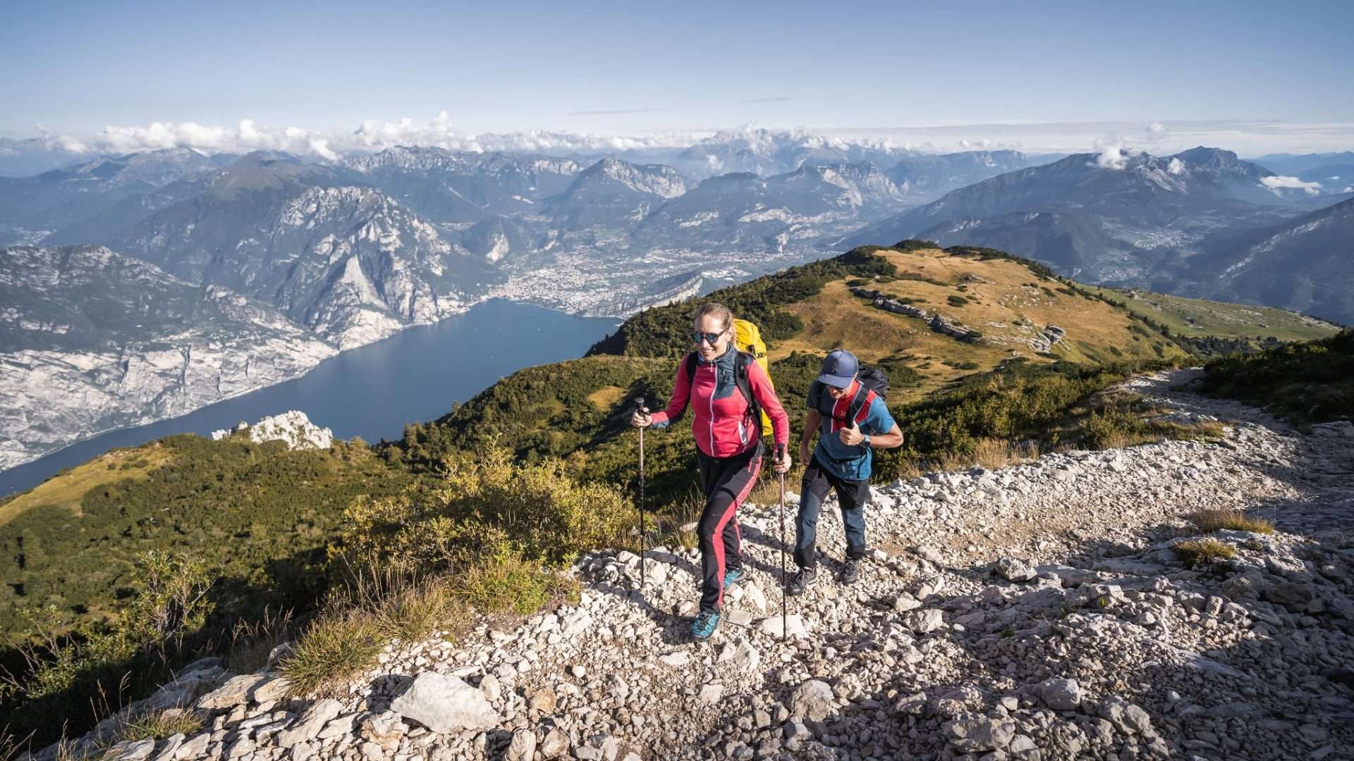
BrentonicoThe Altissimo di Nago, at 2,079 metres, is the northernmost peak of Monte Baldo and dominates the entire northern part of Lake Garda with authority. Climbing to the Rifugio Damiano Chiesa, built a few metres below the peak back in 1892, means reaching one of the most extraordinary panoramic balconies in the Alps, with a 360 degree view that on a clear day embraces the Dolomites, the Po Valley and the western Alps.
The panorama from Rifugio Altissimo towards Lake Garda. Photo: Garda Trentino Archive (ph. Watchsome)
The classic route starts from San Valentino (1,329 m), a small hamlet that can be reached by car from Brentonico. From here, take the Sentiero delle Vipere (n. 650), which climbs through meadows and beech woods to Bocca del Creer (1,617 m), where the Graziani Refuge is located. From this point, continue along path no. 633, which follows an old military road dating back to the First World War – of which trenches, communication trenches and emplacements can still be seen today – to the hut and the summit cross.
The entire ascent takes about three and a half hours, with a positive height difference of 730 metres. The final panorama amply repays the effort: Lake Garda appears as a blue jewel set between the mountains, and on windy days you can understand why this area is a favourite destination for paragliders.
The Rifugio Damiano Chiesa, run by the SAT di Mori (SAT of Mori), offers refreshments and overnight accommodation in the summer season, making a comfortable two-day excursion possible with an afternoon departure and sunrise on the summit.
Characteristics
Directions
From the Malcesine - Monte Baldo cable car station (elevation 1,760 m), take the ridge trail heading north towards Rifugio Damiano Chiesa (Cima Telegrafo). The route follows the Monte Baldo ridge crest with panoramic views on both sides.
After approximately 2 hours of walking along the ridge, you reach Rifugio Altissimo at 2,060 m, below the Cima Altissimo of Monte Baldo. The return is via the same route.
How to get there
By cable car: from Malcesine take the rotating cable car to Monte Baldo (arrival station at 1,760 m). By car: from Brentonico drive towards San Giacomo and Rifugio Graziani, from which alternative trails depart.
Where to park
If taking the cable car: paid parking in Malcesine. If driving up from the Trentino side: parking at Bocca di Navene or San Giacomo.
Starting point coordinates
Recommended gear
Mountain boots, windproof jacket and thermal layer (temperatures drop even in summer at this elevation). At least 2 liters of water, food, and sunscreen. Trekking poles recommended.
Safety
High altitude route exposed to rapid weather changes. Do not depart if thunderstorms are forecast. Some sections of the ridge are exposed. In case of fog the trail may be difficult to follow. Emergencies: 112.
Loading forecast...

Need help planning?
Our AI assistant knows every trail around Lake Garda.
 Ask about this route...


