

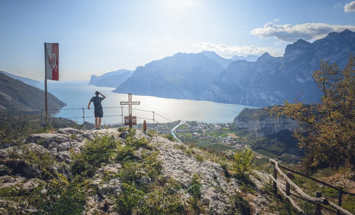
The Garda Trek Top Loop is the great trekking of the Upper Garda: 95 km in 7 stages with 5500 metres of total elevation gain traversing the ridges and peaks of the mountains surrounding the lake. A challenging multi-day adventure that offers unforgettable views, from the summit of Monte Baldo to the forests of Valle di Ledro.
The 7 stages
The trek starts from Riva del Garda and develops in a loop, touching the highest mountains of the upper lake. Each stage has an average height difference of about 800 metres and a 4-6 hour walk, crossing environments ranging from beech forests to alpine meadows above 2000 metres.
The panoramic viewpoints are countless: from Lake Garda seen from above, a blue ribbon set between green mountains, to views of the Brenta Dolomites and Adamello. The route passes through remote and little-visited areas where the mountain shows itself in its most authentic form.
Refuges and hospitality
Each stage ends in a refuge or a small mountain village where Trentino cuisine welcomes tired but satisfied trekkers. Canederli, strangolapreti, polenta with malga cheese and strudel are the daily fuel of the walk. Reservations are essential, especially in July and August.
Practical advice
Challenging trek reserved for well-trained and experienced mountain hikers. Complete trekking equipment: high boots with Vibram soles, 40-50 litre rucksack, layered clothing, rain jacket, poles. Bring a first aid kit. The ideal period is July-September. Luggage transport between stages available on request. Possibility of shortening the route by returning to the valley at the end of individual stages.
Characteristics
Directions
The Garda Trek Top Loop is the highest route of the three Garda Trek rings. This multi-stage itinerary follows the ridges and peaks that surround the upper Lake Garda, with breathtaking panoramas.
The route touches Monte Altissimo, the ridge of Monte Baldo, Rifugio Damiano Chiesa and descends towards Riva del Garda through alpine trails. It is a multi-day trek with overnight stays in mountain huts.
How to get there
By car or public transport: reach Riva del Garda as the starting and ending point. About 20 minutes from Rovereto. Train to Rovereto, then bus.
Where to park
Parking in Riva del Garda (thermal area or town center). Fee applies in summer.
Starting point coordinates
Recommended gear
Complete trekking equipment for multiple days: 40-50 liter backpack, mountain boots, layered clothing, waterproof jacket, sheet sleeping bag for huts. Trekking poles, water, food, sunscreen, first aid kit. Map and GPS.
Safety
Challenging high mountain trek for experienced hikers. Book huts in advance. Check weather conditions daily. Some sections are exposed and require secure footing. Do not attempt in case of thunderstorm. Emergencies: 112.
Loading forecast...
Need help planning?
Our AI assistant knows every trail around Lake Garda.
 Ask about this route...


