

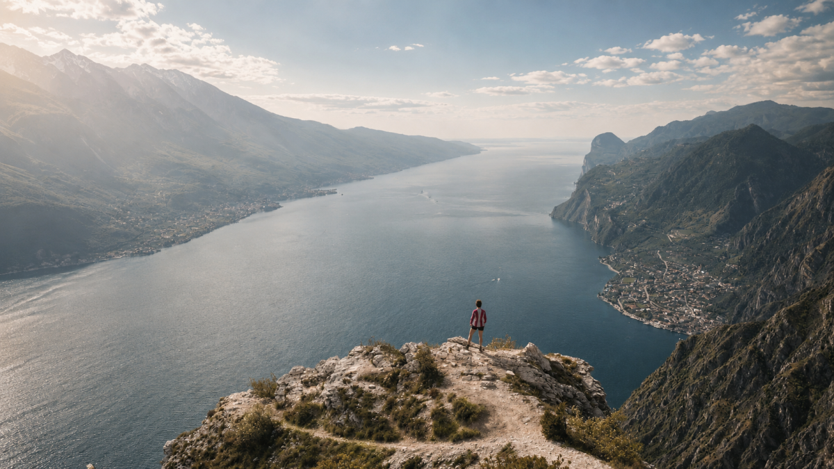
The hike to Punta Larici from Pregasina is one of the most rewarding in the upper Lake Garda area: in just 5 km and 350 metres of elevation gain, you reach one of the most spectacular natural belvederes of Lake Garda, with an aerial view of the confluence of the three branches of the lake that takes your breath away.
The route
You start out from Pregasina, a small village at 530 metres above sea level that can be reached by car from Riva del Garda or on foot from the Sentiero del Ponale. The path climbs gently through woods of holm oak and ash, with ever-widening views of the lake below. The trail is well signposted and does not present any technical difficulties, although some sections are steep.
Punta Larici (791 m) is a promontory that juts out into the void above the lake. From the natural viewing platform, Garda stretches 700 metres below with a view that encompasses all three directions of the lake – to the south the widest part, to the north-east the Malcesine branch, to the west Limone and the Brescian mountains.
The panorama
Punta Larici is considered by many to be the most beautiful vantage point on Lake Garda. The position is unique: you are suspended in the void above the geometric centre of the upper lake, with an almost 360 degree view. Paragliders taking off from the meadow below add a touch of colour and dynamism to the panorama. It is a photographic location of the first order.
Practical tips
Short but scenic hike, suitable for intermediate hikers. Hiking shoes recommended. Beware of the wind at the summit, which can be strong. Bring water. The route is exposed to the sun in the afternoon – in summer, start in the morning. Walkable from March to November. Can be combined with the Ponale Trail for a full day.
Characteristics
Directions
From Pregasina (small village above Riva del Garda) take the trail that climbs towards Punta Larici. The route crosses woods and meadows with increasingly spectacular views of Lake Garda.
You will reach Punta Larici (732 m), one of the most spectacular viewpoints of Lake Garda: the view encompasses the entire upper lake, from Riva to Malcesine, with the mountains surrounding the basin. It is also a launching point for paragliding. The return is via the same route.
How to get there
By car: from Riva del Garda take the SS240 towards Lake Ledro, turn towards Pregasina after the Ponale tunnel. From Riva approximately 15 minutes. By public transport: bus to Pregasina (limited service).
Where to park
Parking in Pregasina, in the village center. Limited spaces. Alternatively, park along the road just before the town.
Starting point coordinates
Recommended gear
Light trekking shoes. Water, sunscreen, hat. In spring/autumn light jacket. Camera recommended for the panorama.
Safety
Generally safe trail. The Punta Larici area is a paragliding launch point: pay attention to takeoffs and landings. Some scenic sections are unprotected. Dogs allowed on leash. Emergencies: 112.
Loading forecast...
Need help planning?
Our AI assistant knows every trail around Lake Garda.
 Ask about this route...


