

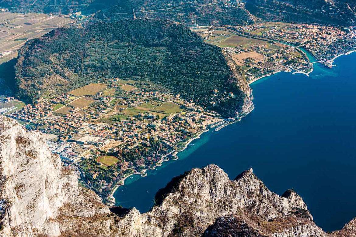
Mount Brione is a rocky spur that juts out at the northernmost point of Lake Garda, separating the waters of Riva del Garda from those of Torbole. Despite its modest altitude, this small mountain offers glimpses of the lake of rare beauty and preserves on its flanks some of the best preserved military structures of the Upper Garda, dating back to the Great War.
The main path follows the route called the Sentiero della Pace (Peace Path) and winds through terraced olive groves, holm-oak woods and open glades that reveal sudden windows onto the lake. The ascent is regular, with dirt steps and protective metal ropes in the steepest sections. In about thirty minutes from the bottom of the valley you reach Forte Garda, a well-preserved defensive complex with a magnificent view of the Rivana ‘Riviera’.
Continuing upwards we come to the Batteria di Mezzo, another military structure surrounded by greenery, and finally the summit cross, the highest point of the excursion. The entire loop takes about two and a half hours, during which the lake is shown from ever different angles, from the fjord of Riva to the more open waters towards Malcesine.
Monte Brione is now a protected biotope, a precious treasure chest of biodiversity with typically Mediterranean flora at surprisingly northern latitudes. A short but rich excursion, recommended in every season.
Characteristics
Directions
From the parking area along Via Brione in Riva del Garda, take the trail that climbs through the Mediterranean forest. The loop route crosses the area of Austro-Hungarian forts, with informational panels about the biotope's history.
You reach the ridge of Monte Brione with views of Riva del Garda on one side and Torbole on the other. The descent takes place down the opposite slope, completing the loop.
How to get there
By car: Monte Brione is located between Riva del Garda and Torbole. From Riva, follow Via Brione heading east. From Rovereto approximately 20 minutes. By public transport: bus to Riva del Garda or Torbole, then 10 minutes on foot to the starting point.
Where to park
Parking along Via Brione, free of charge. Alternatively, parking areas in Riva del Garda (10 minutes on foot).
Starting point coordinates
Recommended gear
Sneakers or light trekking shoes. Water, sunscreen. In winter the route is often sunny and pleasant.
Safety
Trail generally safe. Some panoramic points on the ridge are unprotected: be careful with children. Route suitable for families.
Loading forecast...
Need help planning?
Our AI assistant knows every trail around Lake Garda.
 Ask about this route...


